Log in
All resources
Create a design
38,374 Free Images of Atlas
atlas topographique des environs de paris (1780)
bibliothèque nationale de france
copper engraving print
british library
joan blaeu
new york botanical garden
luesther t. mertz library
bacillariophyceae
1667 maps
history
atlas sive cosmographicae (gerardus mercator, 1623)
maps of china by mercator-hondius
atlas sive cosmographicae (gerardus mercator, 1623)
maps of south ireland by gerardus mercator
atlas sive cosmographicae (gerardus mercator, 1623)
maps of europe by mercator-hondius
atlas sive cosmographicae (gerardus mercator, 1623)
maps of the americas by mercator-hondius
atlas sive cosmographicae (gerardus mercator, 1623)
maps of wiflisburgergau by gerardus mercator
atlas sive cosmographicae (gerardus mercator, 1623)
maps of italy by gerardus mercator
atlas sive cosmographicae (gerardus mercator, 1623)
maps of benelux by gerardus mercator
atlas maior, vol 12 (america) - joan blaeu, 1667 - bl 114.h(star).12
1667 maps
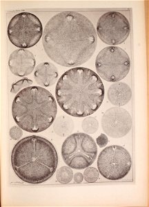
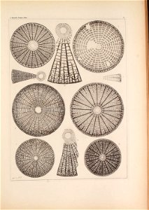
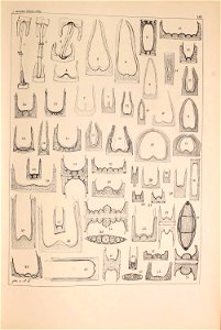
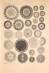
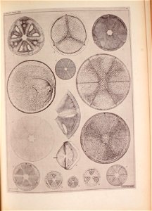
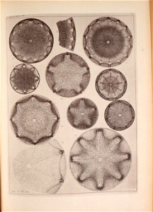
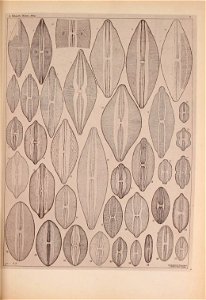
illustrations from atlas de zoologie (1844)
paul gervais (zoologist)
churbaierischer atlas - klöster
kloster raitenhaslach
old maps of amersfoort
hoogland
atlas topographique des environs de paris (1780)
bibliothèque nationale de france
atlas topographique des environs de paris (1780)
bibliothèque nationale de france
atlas topographique des environs de paris (1780)
bibliothèque nationale de france
atlas topographique des environs de paris (1780)
bibliothèque nationale de france
atlas topographique des environs de paris (1780)
bibliothèque nationale de france
atlas topographique des environs de paris (1780)
bibliothèque nationale de france
atlas topographique des environs de paris (1780)
bibliothèque nationale de france
atlas topographique des environs de paris (1780)
bibliothèque nationale de france
atlas topographique des environs de paris (1780)
bibliothèque nationale de france
atlas topographique des environs de paris (1780)
bibliothèque nationale de france
atlas topographique des environs de paris (1780)
bibliothèque nationale de france
atlas topographique des environs de paris (1780)
bibliothèque nationale de france
atlas topographique des environs de paris (1780)
bibliothèque nationale de france
atlas topographique des environs de paris (1780)
bibliothèque nationale de france
atlas topographique des environs de paris (1780)
bibliothèque nationale de france
atlas topographique des environs de paris (1780)
bibliothèque nationale de france
atlas topographique des environs de paris (1780)
bibliothèque nationale de france
atlas topographique des environs de paris (1780)
bibliothèque nationale de france
atlas topographique des environs de paris (1780)
bibliothèque nationale de france
atlas topographique des environs de paris (1780)
bibliothèque nationale de france
atlas topographique des environs de paris (1780)
bibliothèque nationale de france
atlas topographique des environs de paris (1780)
bibliothèque nationale de france
atlas topographique des environs de paris (1780)
bibliothèque nationale de france
atlas topographique des environs de paris (1780)
bibliothèque nationale de france
atlas topographique des environs de paris (1780)
bibliothèque nationale de france
atlas topographique des environs de paris (1780)
bibliothèque nationale de france
atlas topographique des environs de paris (1780)
bibliothèque nationale de france
atlas topographique des environs de paris (1780)
bibliothèque nationale de france
atlas topographique des environs de paris (1780)
bibliothèque nationale de france
atlas topographique des environs de paris (1780)
bibliothèque nationale de france
atlas topographique des environs de paris (1780)
bibliothèque nationale de france
atlas topographique des environs de paris (1780)
bibliothèque nationale de france
atlas topographique des environs de paris (1780)
bibliothèque nationale de france
atlas topographique des environs de paris (1780)
bibliothèque nationale de france
atlas topographique des environs de paris (1780)
bibliothèque nationale de france
atlas topographique des environs de paris (1780)
bibliothèque nationale de france
atlas topographique des environs de paris (1780)
bibliothèque nationale de france
atlas topographique des environs de paris (1780)
bibliothèque nationale de france
atlas topographique des environs de paris (1780)
bibliothèque nationale de france
gray's anatomy plates with help
human atlas
churbaierischer atlas - klöster
kloster ebersberg
historical
history
historical
history
historical
history
historical
history
historical
history
churbaierischer atlas - klöster
neumarkt-sankt veit
planet
maps
historical
history
historical
history
historical
history
history
project
atlas maior, vol 7 (france i) - joan blaeu, 1667 - bl 114.h(star).7
1667 maps
atlas maior, vol 3 (germany) - joan blaeu, 1667 - bl 114.h(star).3
copper engraving print
atlas maior, vol 4 (netherlands) - joan blaeu, 1667 - bl 114.h(star).4
1667 maps
atlas maior, vol 4 (netherlands) - joan blaeu, 1667 - bl 114.h(star).4
1667 maps
atlas maior, vol 1 (northern europe, norway, and denmark) - joan blaeu, 1667 - bl 114.h(star).1
1667 maps
atlas maior, vol 3 (germany) - joan blaeu, 1667 - bl 114.h(star).3
copper engraving print
atlas maior, vol 8 (france ii and switzerland) - joan blaeu, 1667 - bl 114.h(star).8
1667 maps
atlas maior, vol 1 (northern europe, norway, and denmark) - joan blaeu, 1667 - bl 114.h(star).1
1667 maps
atlas maior, vol 1 (northern europe, norway, and denmark) - joan blaeu, 1667 - bl 114.h(star).1
1667 maps
atlas maior, vol 3 (germany) - joan blaeu, 1667 - bl 114.h(star).3
copper engraving print
atlas maior, vol 9 (italy) - joan blaeu, 1667 - bl 114.h(star).9
1667 maps of italy
atlas maior, vol 1 (northern europe, norway, and denmark) - joan blaeu, 1667 - bl 114.h(star).1
copper engraving print
atlas maior, vol 1 (northern europe, norway, and denmark) - joan blaeu, 1667 - bl 114.h(star).1
1667 maps
atlas maior, vol 3 (germany) - joan blaeu, 1667 - bl 114.h(star).3
17th-century maps of silesia
atlas maior, vol 1 (northern europe, norway, and denmark) - joan blaeu, 1667 - bl 114.h(star).1
1667 maps
atlas maior, vol 9 (italy) - joan blaeu, 1667 - bl 114.h(star).9
1667 maps of italy
atlas maior, vol 2 (sweden, russia, poland, eastern europe, and greece) - joan blaeu, 1667 - bl 114.h(star).2
17th-century maps of romania
atlas maior, vol 1 (northern europe, norway, and denmark) - joan blaeu, 1667 - bl 114.h(star).1
1667 maps of europe
atlas maior, vol 8 (france ii and switzerland) - joan blaeu, 1667 - bl 114.h(star).8
1667 maps
atlas maior, vol 3 (germany) - joan blaeu, 1667 - bl 114.h(star).3
copper engraving print
atlas maior, vol 9 (italy) - joan blaeu, 1667 - bl 114.h(star).9
1667 maps of italy
atlas des anciens plans de paris by imprimerie nationale, 1880 from bhvp
map of paris by françois quesnel
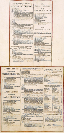
atlas van der hagen (volume 2)
atlas van der hagen
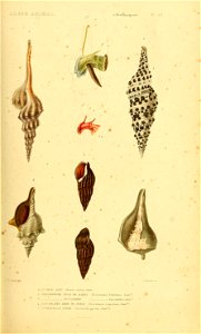
sea life
shell
atlas
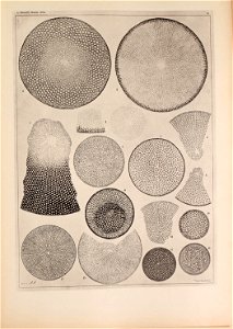
cell
atlas
germ
atlas
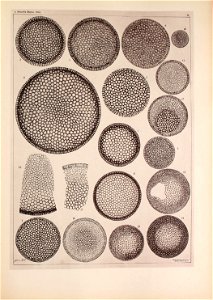
cell
atlas
cell
atlas
cell
weinberger
atlas
atlas
germ
atlas
germ
atlas
cell
atlas
cell
atlas
cell
atlas
cell
atlas sive cosmographicae (gerardus mercator, 1623)
maps of berry by gerardus mercator
10601 - 10700 of 38,374
Next page
/ 384